Nguyen Hong Thao[1]
On August 15, 2014, Li Dexia and Tan Keng Tat, in their RSIS[2] Commentary entitled “South China Sea disputes: China has evidence of historical claims”, asserted that the commentary of Bill Hayton, “The Paracels: Historical evidence must be examined,” which was published on July 3, 2014, has no merit. The authors stated that in fact the Philippines submitted 4,000-page files to the International Tribunal to defend their claims; therefore a two-page commentary is certainly inadequate. However, the authors themselves also used their just-two-page commentary to present a series of the so-called “historical evidences” to stress that the China’s territorial claim is based on centuries of verifiable historical records, long-term use, treaties as well as international/customary laws. These evidences should not be accepted without debating and examining, as proposed by Bill Hayton. This scientific and objective method serves as concrete foundation for a peaceful solution to the East Sea (South China Sea) disputes, instead of unilateral use of force or bullying “small fishes” in international relations.
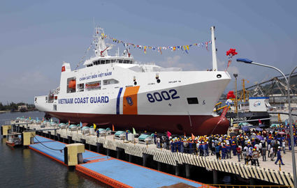 |
| Vietnam Coast Guard ship 8002 is launched for maiden voyage__Photo: Le Tam/VNA |
Earliest Chinese references
The authors referred to the 13th century book “Chu Fan Chi” (Zhu Fan Zhi - Notes for Foreigners or Records of Foreign Peoples) by Zhao Ju Guo (Chau Ju-kua) (Song Dynasty, 1225), in which the words “Chien-li chang-sha” and “Wan-li shih-chuang” appeared, to conclude that the Paracels belong to China’s territory. In fact, “Chu Fan Chi” was the book about the “vassal kingdoms” or “barbarous tribes” as China despised its neighboring countries in the feudal time. Consequently, it is obvious that the lands recorded in this book were not Chinese. There were absolutely no detailed descriptions or coordinates for Bill Hayton or any other author to authenticate the “Wan-sheng shih tang” or “Shih-shing Shi-tang” as Paracels or Spratlys. Moreover, this book is not a historical record officially written by the imperial court’s authors but merely personal diary; whilst all the universally-recognized maps issued by China during this period unanimously described Hainan island as the Southern terminus of China.
Territorial activities are only recognized by international laws when they were conducted by the State, not individual, let alone what was recorded simply in a personal memoir that has never been verified. The sea voyages in the years of 1292 and 1405-1433, etc., as cited by the authors, could not bring about the sovereign rights as they were against the principle of navigation freedom in the sea. If based only on their arguments, the Vietnamese coast or the Javanese coats of Indonesia also belonged to China’s territory since Zheng He passed by. The Vietnamese fishermen might be unable to travel a journey of 250 nautical miles in 1405 as the authors asserted, but the voyage conducted by Prince Ly Long Tuong (Lee Yong Sang or Lee Hwasan by Korean), who later became the well-known Korea’s General Lee of Hwasan for his contribution to the Korea’s defeat of the Mongol invaders, from Vietnam, passing through Taiwan, to Korea in 1226 was in fact recorded in the history. This distance must be many times longer than 250 nautical miles. China, after Ming dynasty, also adopted the “closed-door policy” and turned its back on the sea. Both Vietnamese official historical records and Western reports documented that Annam was the first state that offically deployed Hoang Sa Company in Paracels and Spratlys, at least since 17th century. That completely met the demand of international laws.
Ignoring historical evidence
According to the 1887 Convention on land border signed between France and the Qing dynasty of China, the islands located east of the red line belonged to China. This red line described on the map attached to the Convention was only 5 kilometers long, compatible with the width of the territorial waters of 3 nautical miles at that time, and functioned to demarcate the onshore islands within Tonkin Gulf. If following the authors’ interpretation, this line could be extended boundlessly, crossing the Tonkin Gulf, and not only Paracels and Spratlys but also Hue, Da Nang and even all the islands along the Central Coast of Vietnam or Con Dao island, also belonged to China consequently. In the negotiation to demarcate Tonkin Gulf, China indeed saw Bach Long Vy island locating west of the red line and, therefore, belonged to China’s territory. So what is official argument?
Hungdar Chiu and Choon Ho Park may claim that China discovered Paracels before Vietnam. Nevertheless, according to international laws, discovery cannot bring about sovereignty, but merely serves as an initial step and would be nonsense given the lack of other intensification activities of the State after that. All the historical records and maps of China proved the contrary that until early 20th century, the Southern terminus of China was Hainan island.
Vietnam’s Foreign Ministry also rejected when China misquoted the late Prime Minister Pham Van Dong’s letter in 1958. The letter merely showed support of the principle of 12 nautical miles for territorial waters, made no mention of any name of Hoang Sa or Truong Sa.
The Cairo, Potsdam and San Francisco Conferences requested Japan to relinquish all territories it had invaded before by force and greed. There were absolutely not any agreements to return all these territories to only China. In contrast, the Soviet Union’s proposal which was Japan’s recognition of the People’s Republic of China’s sovereignty over Paracels and Spratlys in San Francisco Conference in 1951 was rejected with 46 votes against, 3 votes in favor and 2 abstentions, whilst none of the 51 participating countries protested when Prime Minister Tran Van Huu reaffirmed Vietnam’s long-standing sovereignty over Paracels and Spratlys.
The authors were too hasty to state that from 1946 to 1956 France and the Republic of Vietnam did not challenge China’s claims over these islands. At the end of 1946, Cheng Kai-Shek violated the agreement with France when making use of Japan’s disarmament to invade An Vinh islands. France, who wanted to avoid a war, just landed some units on Crescent Islands. In 1947, France then proposed a solution through international arbitration but China rejected. On October 14, 1950, in compliance with Halong Treaty of 1949, France officially handed over the rights of management and protection of Paracels and Spratlys to Bao Dai’s Government. The Governor of the Central Vietnam Phan Van Giao went to the Paracels to chair the handover ceremony. In 1956, the Government of the Republic of Vietnam reorganized the administration of these islands and in compliance with Decree No. 143/VN dated October 20, 1956, the Spratlys were merged into Phuoc Tuy province. The license for guano exploitation in Money, Roberts and Woody Islands (Paracels) issued by the Ministry of Economics of the Republic of Vietnam in 1956 has been kept until now.
It is obvious that the historical and judicial evidences of related parties should be verified and examined unbiasedly by a third party if the related parties cannot reach agreement. If China believed that it has undisputable sovereignty why it rejected the Philippines’ suggestion on the international tribunal’s decision. China should behave as a big power which is responsible for peace, security and stability of the region. The small countries welcome a China rising peacefully, but never accept the use of force and the unreasonable U-shaped line in the East Sea. This lesson has been being verified by history.-
[1] Associate Professor at the Diplomatic Academy of Vietnam and the Hanoi National University, Vietnam. His views are strictly his own and do not reflect any official stance.
[2] S. Rajaratnam School of International Studies at Nanyang Technological University, Singapore.