Nguyen Thi Lan Anh[1] Ph.D.
Islands may generate maritime zones in the same foot as land territory. This possibility led to the fact that islands have been made use of to generate excessive maritime claims in state practices. To some extent, these practices are diluting the coherence and the main purpose of the regime of islands in international law. Such excessive claims, fortunately, are seldom accepted in the case of standing-alone-islands. In most other scenarios, particularly with the wrong-side and distant islands, the effect of islands in maritime delimitation has been significantly reduced in the practices of both states’ negotiations and judgments of judicial bodies. This reality will be a high alert for the big illusion of states in using islands for their maritime claims. In connection with the South China Sea, the features may also entitle limited maritime effect. Acknowledgement of such prospect may help the parties better manage the disputes in the South China Sea as well as constructively strive for dispute settlement.
(Continued from issues 234-235)

Islands and maritime effect in maritime delimitation practices
Maritime delimitation was clearly defined as a process in which the equidistant line is firstly and provisionally constructed and then, asking for the adjustment of this line based on the presence of relevant circumstances in order to reach equitable result.[2] Among some possible relevant circumstances, the presence of islands of the parties to the dispute was usually considered a relevant circumstance. However, their effect in maritime delimitation has been treated in different ways in case law and state practice according to their size and their location in respect of the coasts between which the boundary will be drawn. With the “wrong side” or “midway” islands, their effects in maritime delimitation are normally reduced for the effect of the mainland of coastal states.[3] This is particularly true in the case of small and uninhabited islands. In the Anglo-French Arbitration,[4] there were three features which led to the adjusting of the equidistance line, namely Eddystone Rock, Channel Island and Scilly Islands. With its adjacent position to the French coastline, the Eddystone was given full effect.[5] Meanwhile, located on the wrong side which is very near the French mainland, the Channel Island was enclave with only 12 nautical miles[6] and the Scilly Island was of half effect.[7] Even with some larger islands like the Jan Mayen in the Jan Mayen case,[8] which is 30 miles long and two miles wide, and the Kerkenas Island, with considerable population, economic significance and a large area of 69 square miles in the Tunisia/Libya case,[9] both were given approximately half effect in maritime delimitation. Similar conclusions can also be found in cases namely the Gulf of Maine[10] and Libya/Malta[11] cases. In St Pierre and Miquelon Arbitration,[12] the St Pierre and Miquelon Islands were capable of generating full maritime zones, but were only given 24 nautical miles in the Western segment of the maritime boundary. A reduced effect was also found the wide of their maritime zones in the Southern segment where there was no obstruction with opposite or literally aligned with the Canadian coasts.[13] In the Dubai and Sharjah Arbitration in 1981, the Abu Musa was only given 12 nautical miles of territorial sea and no continental shelf.[14] In the recent case of Eritrea/Yemen Arbitration, small islands, namely the single island of al-Tayr and the island group of al-Zubayr were even discounted altogether.[15] In Qatar v. Bahrain, the Court also reduced the effect of the small island of Qit’at Jaradah in order to avoid proportionality.[16] In Cameroon v. Nigeria, islands belong to a third country was also ignored as relevant circumstances in maritime delimitation.[17] In Rumania v. Ukraine, the Court considered that “it was not necessary to consider the Serpent Island the island under para.2 or islands under para.3 of Article 121 in order to delimit the overlapping maritime zones between Rumania and Ukraine”.[18] As a result, the Serpent Island was given 12 nautical miles. In Bangladesh v. Myanmar, the Tribunal considered that “St. Martin’s Island was not a relevant circumstance and, accordingly, decided not to give any effect to it in drawing the delimitation line of the EEZ and the continental shelf”.[19]
The same approach was found in state practice. For example, in the Torres Strait Treaty between Australia and Papua New Guinea,[20] a number of small islands of Australia in the Torres Strait which located on the wrong side and very near the coastline of Papua New Guinea are only given three nautical miles of territorial sea and no effect on continental shelf delimitation. In 12 other maritime delimitation treaties namely the delimitation of Colombia-Jamaica, Finland-Sweden, Dominican Republic-United Kingdom (Turks and Caicos), Thailand-Vietnam, Equatorial Guinea-Nigeria, Ireland-United Kingdom, Iceland-Norway, Saudi Arabia-Yemen, Estonia-Finland-Sweden, Algeria-Tunisia, Italia-Tunisia and Italia-Yugoslavia, the effect of small islands was also discounted or ignored.[21]
The case law and state practice show that the ability of a small island in generating maritime zones depends on the size of the island, its population and its location. The closer the island is to the mainland of its country, the greater its power is to generate a full zone. In contradiction, if the island is located on the wrong side or at the middle of the meridian line dividing the overlapping maritime zones of two adjacent or opposite states, the further away the island is, the weaker the effect that island is able to generate. In some situations, if the maritime zones of islands cause distortion for the maritime delimitation, the islands may exert no effect.[22] In all the discussed cases, small islands have a maximum of half effect in maritime delimitation, even with those islands which have considerable population and economic significance such as the Kerkenas in the Tunisia/Libya case.[23] It is also noteworthy that the maximum half effect of all the small islands in these cases was obtained with the backup of the coastline from the mainland.[24] Therefore, it is submitted that without the supportive effect of the mainland, the islands would have less effect if they stood individually in maritime delimitation with a mainland. That is to say even states make use of islands to generate excessive maritime claims, such claims will not be assured in maritime delimitation.

Implication for the South China Sea dispute
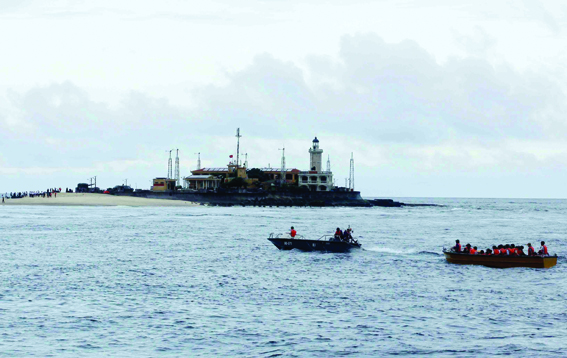
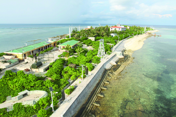
With regard to the South China Sea dispute, the Spratlys is located in the middle of the South China Sea and comprises hundreds of features. Since many features are very tiny in size, they have not been named consistently by individual or group, thus the reported number of features in the Spratlys can vary from 148 to 235. The Spratlys is located between 4 and 12°N and between 109 and 118°E approximately.[25] The shortest distances from littoral states to the center of the Spratlys are measured as about 200 nautical miles from the Brooke’s Point of the Philippines, 330 nautical miles from the Southern coast of Vietnam, 247 nautical miles off the coast of Malaysia, 405 nautical miles from southern islands in the Paracels archipelago, 540 from the Hainan Island of China and 860 from Taiwan.[26] The whole group occupies nearly 160,000 square kilometers[27] with a coastline totaling some 926 kilometers.[28] Of all the features in the Spratlys, only about 20 percent will be able to sustain human life, since the rest either are too small or do not always emerge above water.[29]
Applying the provision of Article 121 to the case of the Spratlys, one can easily reach the following conclusions:
i. As not all of the features in the Spratlys are above water at high tide, thereby not all of the features are islands. Many of them actually are low tide elevations or submerged features.
ii. Within those features that can be considered islands, not all of them can be used to generate full maritime zones under the condition set forth under Article 121.3, thereby many of them, if not all, actually are rocks.
Even if some of the islands of the Spratlys can be considered islands under Article 121.2, i.e., can generate full maritime zones, due to the overlapping with the maritime zones from the mainland of the littoral states, the islands will have to reduce significant effect in maritime delimitation. The consistent state practices show that islands with similar geographical characteristics to those of the Spratlys will be enclave with 12 nautical miles.
Acknowledging the geographical characteristic of the Spratlys as well as the applicable law of Article 121 of UNCLOS, the parties concerned in the South China Sea have addressed the legal regime of the features of the Spratlys in domestic legislations or declarations in one way or another.
China, by the provisions of the 1992 Law on Territorial Sea and the Declaration on the baselines of the territorial sea and deposited to the UN the Lists of Geographical Coordinates,[30] has established the archipelagic baseline for the Paracels. The highlight is the establishment has unilaterally conducted by China despite the Paracels is the subject of a sovereignty dispute between China and Vietnam. It is also noteworthy to mention that the baseline established by China in the Paracels is not in accordance with the provisions of UNCLOS because the baseline system is constructed by the archipelagic baseline, connecting the outermost points of the farthest islands in the Paracels, while as China is a continent country, despite the prospects for the sovereignty issues, the archipelagic baseline cannot be applied.
In 2009, in a series of Note Verbals concerning the submissions on the extended continental shelf of Vietnam and Malaysia, China has expressed the position that China “enjoy the sovereign rights and jurisdiction over the relevant water as well as the seabed and subsoil thereof” and attached the nine-dash line map.[31] In another Note Verbal in 2011, China repeated this statement and made another position that, under the relevant provisions of UNCLOS, as well as the Law on Territorial Sea and Contiguous Zone (1992) and the Law on the EEZ and Continental Shelf (1998), the Spratlys is fully entitled to territorial sea, EEZ and continental shelf.[32]
In addition to EEZ and continental shelf from the Spratlys, China also emphasized on the historical maritime claims. Top leaders of China recently have put forward the official position of historical maritime claims[33] in which China is holding the intention to claim the resources in a vast area within the nine-dash line.

Malaysia has not made any official maritime claims from the mid-ocean features of the South China Sea. However, from the joint submission on extended continental shelf with Vietnam, where the continental shelf was only projected from its mainland, it is inferred that Malaysia considered the features in the South China Sea are only rocks and thus have no EEZ and continental shelf.
The Philippines has a general approach to the legal regime of islands. Article 2 of Act No. 9522 provides that the Kalayaan Island Group (Spratlys) will be determined as “regime of islands”, i.e., the waters shall be according to Article 121 of UNCLOS. However, with the recent initiatives on a Zone of peace, cooperation and friendship (ZoPFF/C), the Philippines argued that the disputed maritime zones can be enclave by 12 nautical miles, and the submerged Reed Bank is not a part of the Spratlys islands. This argument shows that the Philippines consider the islands of the Spratlys as rocks, having no all the exclusive economic zone and continental shelf of themselves.
This position is further endorsed by the statement of the Philippines in the Note Verbal dated April 5, 2011, that since the adjacent waters of the relevant geological features are definite and subject to legal and technical measurement, the claims as well by China on the “relevant waters as well as seabed and subsoil thereof” outside of the aforementioned relevant geological feature in the Kalayaan Island Group and their “adjacent waters” would have no basis under international law, especially UNCLOS. The Philippines further elaborated that “with respect to these areas, sovereignty and jurisdiction or sovereign rights, as the case may be, necessarily appertain or belong to the appropriate coastal or archipelagic state - the Philippines - to which these bodies of waters as well as seabed and subsoil are appurtenant, either in the nature of territorial sea, or 200 nautical mile EEZ, or continental shelf in accordance with Articles 3, 4, 55, 56 can 76 of UNCLOS.”[34]

Vietnam, similar to Malaysia, on its own submission and joint submission with Malaysia has defined the baseline, the boundaries of the EEZ and continental shelf extension. However, Vietnam did not make any claims to EEZ and continental shelf of the islands of the Paracels and Spratlys. Therefore, many scholars have argued that Vietnam also considers the islands of the Spratlys and Paracels as rocks, which cannot generate full maritime zones.[35]
Although not a party to the South China Sea territorial dispute, Indonesia also conveyed an official position that “it is only correct to state that those remote or very small features in the South China Sea do not deserve EEZ or continental shelf of their own. Allowing the use of uninhabited rocks, reefs and atolls isolated from the mainland and in the middle of the high sea as a basepoint to generate maritime space concerns the fundamental principles of the Convention [UNCLOS] and encroaches the legitimate interest of the global community.”[36]
Declarations and domestic legislations of the parties concerned in the South China Sea demonstrate the general trend of the states in the region in considering the Spratlys islands as rocks and thus have no EEZ and continental shelf of their own. This also confirms the fact that mid-ocean features, like the Spratlys, actually cannot help expand maritime zone in the South China Sea. Such consideration is in line with the spirit of Article 121 of UNCLOS. Albeit Article 121 opens for the possibility of generating full maritime zones for islands, taking into account the tiny size and uninhabitable status of the islands in the Spratly, giving no EEZ and continental shelf to these islands would avoid serious distortion to the mainland of littoral states. Such consideration is also a good faith approach that helps narrow down the overlapping maritime zones and therefore, facilitates dispute settlement. Whereas Maritime claims based on historical rights are still questionable in terms of their legal foundation in international law. Maritime claims from historical rights will exaggerate the maritime dispute. Given the most recent China’s assertive activities in notifying the oil blocks in the North and West as well as the harassment of exploration and exploitation of hydrocarbon resources in the East and South of South China Sea, maritime claims based on historical rights seriously hamper the well-established sovereign rights and jurisdiction of littoral states in the EEZ and continental shelf.
In order to facilitate the dispute settlement and set a good image of rule-based friendly countries, the parties concerned should explore ways to reach unified interpretation on the legal regime of the Spratlys. One of the available measures is to negotiate among littoral states and issue a joint declaration on the legal regime of the Spratlys. The other way is to foster the negotiation on the Code of Conduct (COC) and include the issue on the legal regime of the Spratlys as one of the provisions of COC. Alternatively, the parties may reach an agreement and request an advisory opinion from the International Tribunal for the Law of the Sea.[37] While waiting for a consensus on the legal regime of the Spratlys, the parties concerned should conduct a good faith approach by not constructing new facilities and inhabiting on uninhabited features as provided for under point 5 of the Declaration on the Code of Conduct (DOC) 2002.
Resources in the ocean are precious and have long been appreciated by states. In order to explore and exploit ocean resources, coastal states always wanted to expand the maritime zones under their jurisdiction. Islands under Article 121.2 may well serve for that purpose. Islands whatever size or locations have been used as ground to generate excessive surrounding maritime zones. Such application will create a big illusion for states. This assumption may lead to the distortion of international law, creating complicated maritime overlapping zones. Fortunately, state practices showed that this is not only the case, be it in maritime delimitation or in maritime claims. One can observe that the currently overwhelming trend is to interpret and apply Article 121.3 in good faith and restrain the maritime zones generated from islands. This is the guideline for the parties in the South China Sea and, as a result, the most reasonable approach is that the Spratlys islands will only deserve 12 nautical miles. Should the parties concerned be wise enough to accept that approach to set a good image of being rules-based friendly, or they will distort international law and ruin their reputation, the measures are up in their hands at the moment.-
[1] Institute for East Sea (South China Sea) Studies, Diplomatic Academy of Vietnam. The opinions expressed in this paper are those of the author and do not necessarily represent any official position of the Diplomatic Academy of Vietnam.
[2] Ibid, para.230.
[3] Bowett, “Islands, Rocks and Low Tide Elevations in Maritime Boundary Delimitations” in Jonathan I. Charney and Lewis M. Alexander, International Maritime Boundaries, (Dordrucht, Boston and London: Martinus Nijhoff Publishers, 1993, Vol.1), p.131 at 151.
[4] Case concerning the Delimitation of the Continental Shelf between the United Kingdom of Great Britain and Northern Ireland and France Republic, Decision of June 30, 1977, Report of the Arbitration Awards, (1979)18 ILM, p. 339.
[5] Ibid, para.144.
[6] Ibid, paras.189-202.
[7] Ibid, paras.243-251.
[8] ICJ Report, 1993, paras.60-61 and 68-69.
[9] ICJ Report, 1982, paras.79 and 126.
[10] Delimitation of the Maritime Boundary in the Gulf of Maine Area (US v. Canada), Judgment, ICJ Reports (1984), p.246. In this case, the Seal Island, Mud Island and other adjacent features of Canada were given half effect due to their dimensions and geographical position, ICJ Report, 1984, para. 222.
[11] The un-inhabited island of Filfla of Malta was ignored for the application of equitable principle, ICJ Report, 1985, para.64.
[12] (1992) 31 ILM 1145.
[13] For details, see the illustration map and the reasoning of the Arbitration at ibid, p.1148 and paras. 69-71.
[14] Charney et al, International Maritime Boundaries, (Dordrucht, Boston and London: Martinus Nijhoff Publishers, 2005, Vol.5), p.3472.
[15] Eritrea/Yemen Arbitration, paras.147-8.
[16] However, the Court did not give a concrete explanation of the reduction. ICJ Report, 2001, p.40, para.219.
[17] ICJ Report, 2002, p.303, paras.298-9.
[18] ICJ Report, 2009, para.187.
[19] International tribunal on the law of the sea (ITLOS) case No.16, 2012, para. 319.
[20] Jonathan I. Charney and Lewis M. Alexander, Jonathan I. Charney and Lewis M. Alexander, International Maritime Boundaries, (Dordrucht, Boston and London: Martinus Nijhoff Publishers, 1993, Vol.1), Report 5-3, p.929. Those islands are the Anchor Cay, Aubusi Island, Black Rocks, Boigu Island, Bramble Cay, Dauan Island, Deliverance Island, East Cay, Kaumag Island, Kerr Islet, Moimi Island, Saibai Island, Turnagain Island and Turu Cay.
[21] For details, see the analysis of Victor Prescott and Gillian Triggs, “Islands and Rocks and Their Role in Maritime Delimitation” in David Colson and Robert W. Smith (ed.), International Maritime Boundaries, (Leiden and Boston: Martinus Nijhoff Publisher, 2005, Vol.5), p.3245 at 3255-9.
[22] This is also the conclusion of Bowett, “Islands, Rocks and Low Tide Elevations in Maritime Boundary Delimitations” in Jonathan I. Charney and Lewis M. Alexander, International Maritime Boundaries, (Dordrucht, Boston and London: Martinus Nijhoff Publishers, 1993, Vol.1), p.131 and Prescott, ibid.
[23] Continental Shelf Case (Tunisia v. Libya), Judgment, ICJ Report (1982), p.18.
[24] The Jan Mayen was an exception. It stood individually in maritime delimitation with the Greenland without the involvement of the mainland of Norway. However, as the Greenland was also an island, thus they had equal effect in generating maritime zone. Therefore, the reduced effect of the Jan Mayen in maritime delimitation was not because Jan Mayen is an island, but because of the proportionality between the coastal length of the two islands.
[25] Chemillier-Gendreau (Chemillier-Gendreau, Monique. La Souveraineté sur les Archipels Paracelss et Spratleys, (Paris: l’Harmattan, 1996)) described the Spratlys location at 12°N latitude and 111°E longitude; Hancox and Prescott (Hancox, David and Prescott, Victor. “A Geographical Description of the Spratlys Island and an Account of Hydrographic Surveys amongst those Islands” (1997) 1 (6) Maritime Briefing, p.3-30) stated that the location of the Spratlys was 12°N and 112°E; while according to Heinzig (Dieter Heinzig, Dispute Islands in the South China Sea, (Hamburg Institute of Asian Affairs, 1976), p.17) and Marwyn S. Samuels, Contest for the South China Sea, (New York and London: Methuen, 1982), p.188), these figures were between 4 and 11.30°N and between 109.30 and 117.50°E respectively. The last statistic was in line with that of China’s Xinhua News Agency and also used in Odgaard (Odgaard, Maritime Security between China and Southeast Asia: Conflict and Cooperation in the Making of Regional Order, (Ashgate, 2002), p.61).
[26] Cheng-yi Lin, “Taiwan’s South China Sea Policy” (1997) 37(4) Asian Survey, 323 at 328.
[27] Chemillier-Gendreau, op.cit., note 58, p.24.
[28] CIA- The world factbook, online at: https://www.cia.gov/cia/publications/factbook/geos/pf.html (accessed on 18 November, 2004).
[29] Bob Catley and Makmur Keliat, Spratlys: The Dispute in the South China Sea, (Aldershot, Brookfield USA, Singapore and Sydney: Ashgate, 1997), p.3. The lists of features of the Spratlys archipelago is of 148 in Hancox and Prescott (Hancox, David and Prescott, Victor. “A Geographical Description of the Spratlys Island and an Account of Hydrographic Surveys amongst those Islands” (1997) 1 (6) Maritime Briefing, p.3-30 or of 170 in Dzurek (Dzurek, Daniel J. “The Spratlys Island Dispute: Who’s on first? (1996) 2 (1) Maritime Briefing, p.1). Also see Mark J. Valencia et al., Valencia et al., Sharing the Resources of the South China Sea, (London, The Hague, Boston: Martinus Nijhoff Publishers, 1977, for a description of features in Appendix 1, p. 230.
[30] For full text, see www.un.org/Depts/los/LEGISLATIONANDTREATIES/STATEFILES/CHN.htm.
[31] Para. 2 of the Note Verbal of China dated May 7, 2010.
[32] Note Verbal of China dated April 14, 2011.
[33] In his remarks at the ARF 18 in July.
[34] Point 3 of the Note Verbal of the Philippines dated April 5, 2011. For full text, see www.un.org/Depts/los/clcs_new/submissions_files/mysvnm33_09/phl_re_chn_2011.pdf.
[35] Beckman, Presentation at the 2nd International Workshop “The South China Sea: Toward a Region of Peace, Security and Development”, Ho Chi Minh City, 2010.
[36] Point 3 of the Note Verbal of Indonesia dated July 8, 2011. For full text, see https://www.un.org/Depts/los/clcs_new/submissions_files/mysvnm33_09/idn_2010re_mys_vnm_e.pdf.
[37] Article 23 of the Statute of the International Tribunal for the Law of the Sea provides that “[i]f all the parties to a treaty or convention already in force and concerning the subject-matter covered by this Convention so agree, any disputes concerning the interpretation or application of such treaty or convention may, in accordance with such agreement, be submitted to the Tribunal”.