Viet Hoang[1]
Introduction
The story of the “nine-dash line”, the so-called China’s claim in the South China Sea (SCS), or the East Sea as it is called in Vietnam, seems to have sunk into the past after the award of the Arbitral Tribunal in the Philippines case against China in 2016. In this ruling, the Tribunal rejected the so-called “historic rights” of China in the waters within the “nine-dash line”. The idea is that the “nine-dash line” no longer exists after the ruling of the Arbitral Tribunal, but recently, the international press is stirred about the “nine-dash line” but under a new shape.
The South China Morning Post reported a Chinese oceanographic research project that plotted a “new boundary” in the SCS to “facilitate research” on natural resources and “to strengthen China’s claims” in the waters.[2]
The proposed boundary has the shape of a straight line exactly coinciding with the “nine-dash line”, or U-shaped line, which intersects a large area that China claims in the SCS rich in living and non-living resources.
According to the newspaper, “a precise continuous line will split the Gulf of Tonkin between China and Vietnam, go south into the waters claimed by Malaysia, take a U-turn to the north along the west coast of the Philippines and finish at the southeast of Taiwan.”[3]
It covers structural groups on the SCS, including the Spratly Islands, the Paracel Islands, James Shoal and Scarborough Shoal. This line, if adopted, could justify China’s right to engage in acts such as fishing, exploration, and exploitation of energy and minerals, as well as the construction of military bases in the waters within this line.
The Chinese researchers also claimed that their study was based on a map showing the “continuous line” that was published in 1951.[4]
Although this is a research project of only some Chinese scholars, the issue of the “nine-dash line” is a very interesting one, and is an important part of the SCS dispute, one of the most important maritime disputes in the world, and Vietnam is a directly disputed party.
Therefore, this paper will focus on two main issues: First, why do the Chinese scholars release information on this study at the present time? Second, with the introduction of a continuous line, “based on a map that has existed since 1951”, what is its legal nature according to the relevant international law?
Why did China launch this study at this time?
In fact, this is Beijing’s latest attempt to restore its image after a legal defeat in 2016 with the award of Arbitral Tribunal. Beijing denied the award, saying the award “is null and void and has no binding force”.[5]
Officially, the Beijing government has adopted a “three-no” policy: non-participation, non-recognition, and non-compliance. However, since this verdict, China has quietly revised the grounds for its claim by continuously submitting legal documents relating to the nine-dash line map.
In 2017, Chinese scholars even launched a new theory, namely the concept of “Four Sha” in the SCS.[6]
This theory has been criticized by the international scientific community.[7]
So, Chinese researchers are “trying” to find new legal interpretations for this ambition of China on the SCS. Therefore, it led to the “discovery” of a map with a “continuous line” as stated.
International legal experts, such as Prof. Julian Ku, currently working at Hofstra University and scholar Chris Mirasola at Harvard University, asserted that “new Chinese legal claims are not valuable than the previous nine-dash line.”[8]
Indeed, the “new map” proposed by Chinese scholars is just a “new wine in old bottles” effort for the ambition of the Chinese government to control almost the entire SCS.
What is the legal nature of the “continuous line” under international law?
If this map were real, what is the legal basis of this line? To find out about the legal issues for this “continuous line”, we need to find the answers to three questions:
Firstly, with only the “continuous line” map, is this formed an official territorial claim of the Chinese government?
Secondly, what means with a project based on a map dating back to 1951?
Thirdly, is this “continuous line” would become a “national maritime boundary” of China on the SCS?
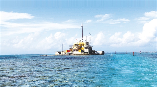 |
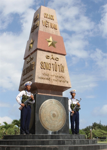
| Da Lat is a reef islet in Truong Sa (Spratly) island district of Khanh Hoa province__Photo: Thanh Lam/VNA |
Is the “continuous line” map a territorial claim of the Chinese government?
First of all, whether it is a map of a dotted line or a map of a continuous line, does the map itself constitute a territorial claim of the Chinese government?
In Burkina Faso/Mali case, the International Court of Justice provided its explanation on the evidentiary value of cartographic evidence:
“Whether in frontier delimitations or international territorial conflicts, maps merely constitute information which varies in accuracy from case to case; of themselves, and by virtue solely of their existence, they cannot constitute a territorial title, that is, a document endowed by international law with intrinsic legal force for the purpose of establishing territorial rights. Of course, in some cases, maps may acquire such legal force, but where this is so the legal force does not arise solely from their intrinsic merits: it is because such maps fall into the category of physical expressions of the will of the State or States concerned. This is the case, for example, when maps are annexed to an official text of which they form an integral part. Except in this clearly defined case, maps are only extrinsic evidence of varying reliability or unreliability which may be used, along with other evidence of a circumstantial kind, to establish or reconstitute the real facts”.[9]
“[M]aps can still have no greater legal value than that of corroborative evidence endorsing a conclusion at which a court has arrived by other means unconnected with the maps. (…) except when the maps are in the category of a physical expression of the will of the State, they cannot in themselves alone be treated as evidence of a frontier, since in that event they would form an irrebuttable presumption, tantamount in fact to legal title. The only value they possess is as evidence of an auxiliary or confirmatory kind, and this also means that they cannot be given the character of a rebuttable or juris tantum presumption such as to effect a reversal of the onus of proof”.[10]
This view has been well received by international legal scholars. Furthermore, as rightly pointed out by Judge Oda in his separate opinion in Kasikili/Sedudu case: “... a claim to territory can only be made with the clear indication of a government’s intention, which may be reflected in maps. A map on its own, with no other supporting evidence, cannot justify a political claim”.[11]
Thus, we find that, based on only one map (without knowing the truthfulness of the map), there is no clear statement that the map expresses the claim of the Chinese government. It would not become a territorial claim. Territorial claims must be made explicit, with the official statement of the state, not that of Chinese “researchers” claiming to be.
What is the “continuous line” based on the map published in 1951?
Chinese researchers, in this case, have said that they have “discovered” a map with a “continuous line” published in 1951. What does this mean?
With this milestone in 1951, it seems that Chinese researchers want it to be “consistent” with declarations of the Chinese government of “historic rights” to the waters within the linesince this point of time was before the 1982 United Nations Convention on the Law of the Sea (the 1982 UNCLOS) was signed. Since the 1982 UNCLOS was signed and entered into force, all concepts of maritime entitlements of coastal states are covered by the Convention.
The 1982 UNCLOS is regarded as the “Constitution for the Oceans” around the world. If based on the Convention, China cannot justify the “nine-dash line”. Therefore, to refute the application of the 1982 UNCLOS, China made a claim on “historic rights” in the waters. “Historical rights” are simply understood as China’s privileges over the resources in this maritime area. Because China thinks that she maintains it long before the 1982 UNCLOS,[12] so it would be given priority not to comply with the provisions of the Convention in this case.
However, the Arbitral Tribunal in the SCS case has ruled on this matter:
“The Tribunal is faced with the question of whether the Convention allows the preservation of rights to resources which are at variance with the Convention and established anterior to its entry into force. To answer this, it is necessary to examine the relationship between the Convention and other possible sources of rights under international law”[13], “The Tribunal concludes that the Convention superseded any historic rights or other sovereign rights or jurisdiction in excess of the limits imposed therein.”[14]
“The Tribunal also examined the historical record to determine whether China actually had historic rights to resources in the SCS prior to the entry into force of the Convention... there was no legal basis for China to claim historic rights to resources, in excess of the rights provided for by the Convention, within the sea areas falling within the ‘nine-dash line’.”[15]
 |
Could the “continuous line” be “a national boundary of China” in the SCS?
The next question is whether the “continuous line” could become “a national boundary” of China in the SCS? Some international researchers argued that the “nine-dash line” was arbitrarily drawn, with no coordinates to identify, and a dotted line, so it was not shown as a serious boundary line.[16]
Maybe for that reason, Chinese researchers, supported by the Chinese government, have been trying to “discover” the map with a “continuous line” to overcome this weakness.
We will return to the Philippines case before the Arbitral Tribunal established under Annex VII of the 1982 UNCLOS.
In the proceedings before the Tribunal, Philippine lawyers proved that: China has some interpretations of the “nine-dash line”. One of the interpretations is to consider the “nine-dash line” as “a national boundary” of China.[17]
However, the Chinese government has officially announced many times: “The Chinese side respects and safeguards all countries’ freedom of navigation and overflight guaranteed by international law.”[18]
According to Philippines lawyers: “Nor is it logical today to regard the nine-dash line as a national boundary. China has made this clear since at least 2014, with its repeated assertions... that it recognizes and respects the freedom of navigation and overflight that international law requires within the line. It is just not plausible that China, as zealous as it has been to safeguard its own sovereignty, would recognize freedom of navigation and overflight of all countries in these waters if it considered them to lie within its national boundary. ”[19]
This legal argument of the Philippines was approved by the Tribunal. The Tribunal concluded: “Within the territorial sea, the Convention does not provide for freedom of overflight or for freedom of navigation, beyond a right of innocent passage. Accordingly, the Tribunal considers China’s commitment to respect both freedom of navigation and overflight to establish that China does not consider the sea areas within the ‘nine-dash line’ to be equivalent to its territorial sea or internal waters.”[20]
Thus, with the official recognition of freedom of navigation and overflight within the “nine-dash line”, the Chinese government has indirectly denied that the line is “a national boundary”, even if it is a “continuous line” or “dotted line”. Because, in accordance with international law, freedom of navigation and overflight cannot exist within the maritime national boundary.
Conclusion
The story of the recent publicity made by some Chinese researchers about a map with a “continuous line” indicates that the ambition of the Chinese government to occupy the SCS has never faded despite of the fact that the award of the Arbitral Tribunal refuses the legal nature of the “nine-dash line”.
China is still trying to find practical ways to turn the “nine-dash line” into reality. That is a reason why, some Chinese scholars “have discovered” the map with the “continuous line” that they say, has been published since 1951.
However, the nature of the so-called Chinese “nine-dash line” claim is illegal, so it is not accepted by international law.-
Remarks on Vietnam’s Statement on the Chinese Government’s Position Paper on Rejecting the Jurisdiction of the Arbitral Tribunal Established at the Request of the Philippines for the South China Sea Arbitration (December 12, 2014).