The nation targets to master remote sensing manufacturing technologies by 2030, according to a decision recently issued by the Prime Minister.
Under Decision 149/QD-TTg, by 2030, the nation will possess technologies to manufacture remote sensing satellites, station systems for receipt and processing of remote sensing data, and remote sensing satellite control stations; take photos of the Earth’s surface from drone equipment and hot air balloons; and build a system to collect and process data of national remote sensing images serving the socio-economic development, national defense and security.
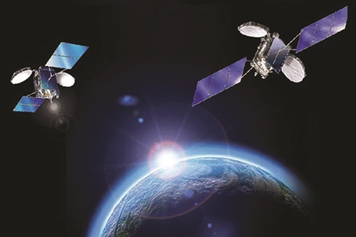 |
| An illustration of Vietnam's Vinasat 1 and Vinasat 2 satellites on their orbits__Photo: Internet |
It is also targeted to widely apply remote sensing technologies and use remote sensing products and data in different sectors and fields, such as baseline survey, observation, natural resources and environmental surveillance, search and rescue, disaster prevention and control, and response to climate change.
One of the tasks set forth in the strategy is to improve the institutions, policies, laws, standards and technical regulations on remote sensing.
Specifically, by 2020, the list of public non-business services in the field of remote sensing and mechanisms for collection and sharing of remote sensing information and data will be completely drawn up while the state management of remote sensing will be enhanced with higher quality personnel.
In addition, it is expected to build and develop a network of remote sensing image data receivers, including fixed stations, mobile stations and virtual stations, a system for remote sensing data storage and processing, and data transmission network to provide remote sensing data to ministries, sectors and localities.
The strategy also aims to develop drone equipment and hot air balloons to collect and provide remote sensing data serving the natural resources and environment surveillance and hydrometeorological forecast.
To develop the national remote sensing image database, it is projected to annually update high-resolution remote sensing images to the database, and ultra-high resolution images of the territory of Vietnam once every five years, and every year for ultra-high resolution images of urban areas.
When necessary, remote sensing data collected by other domestic and foreign stations will also be integrated in the national database.- (VLLF)